 Lon ready for a long drive in the car. He stops playing and talks to us, and watches scenery too.
 Our first stop to look at the view.
  Lon wanted to follow all the hiking paths that he could find. However, we did not do that. Lon was happy to go just a little ways and then pose for photos!
 Where we were. And, yes, I was wearing a yellow shirt
 Beauty shot. It was a beautiful day!
 We stopped in at Win's Drive In. It was in Fairhaven/Bellingham. Lon was telling Daddy that when he got older he would give him an allowance for doing chores, but Mommy would still not get an allowance, but she had to do all the stuff she is doing now anyway.
  Mount Erie. It is fun to climb a mountain in a car! Here is a little bit more on the place!
Mount Erie is a mountain in Skagit County, Washington. The park land is owned and operated by the city of Anacortes and is located in the south of the Anacortes Community Forest Lands.
Mount Erie was named in 1841 by the Wilkes Expedition for the Battle of Lake Erie.[3]The mountain itself was first explored in the 1960s by local climbers, including Dallas Kloke.[4] The mountain is known for its climbing as well as the view from the summit. Mount Erie is a city park operated by the City of Anacortes and the summit is accessible via a single-lane, paved road from the base. At 1,273 feet (388 meters) tall, Mount Erie is the highest point on Fidalgo Island.[1]
The mountain is composed mostly of feldspar and hornblende rich diorite
 Daddy and Lon on the big rock
 Lon wanted to hike the paths and I was the chosen one to go with him! We went down to the another viewing area. Lon liked climbing over the rocks.
  This is the "path" that Lon and I went down. I did it, and we went back up too!
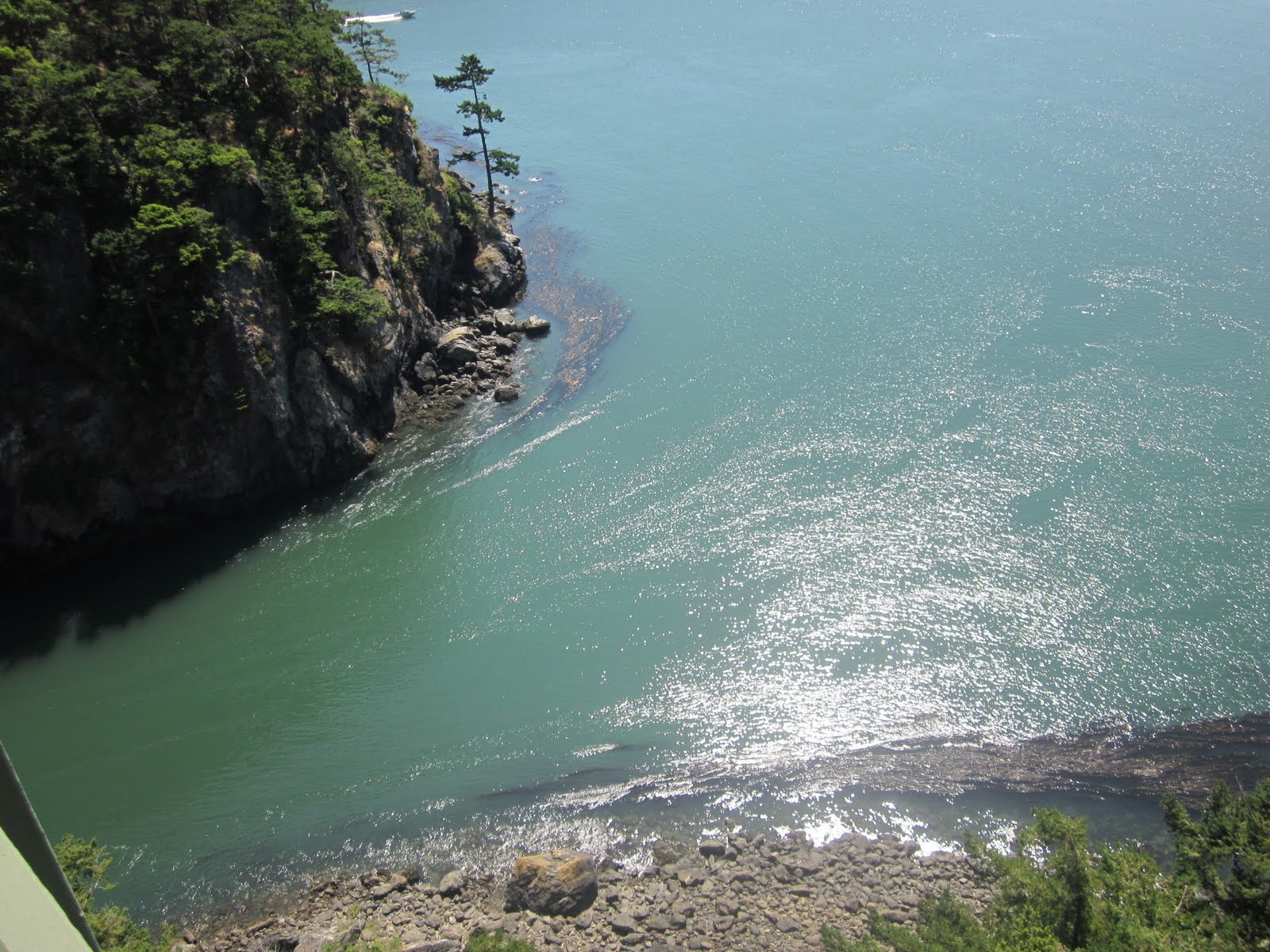 Our next stop was Deception Pass!
There is alot of information on Deception Pass. The pass was named by George Vancouver. There were smugglers there too! It was a pretty exciting place!!
 Crossing the bridge. This was as far as Daddy got, Lon and I went the rest of the way. Really!
 Since the road is super busy, they have a stairway that goes under the bridge so everyone can cross safely without getting hurt or tying up traffic. Lon liked being under the bridge.
 The stairs. They were fun.
  Our long walk back to the car, and we had to go around the corner a little ways too. Lon and I walked. He held my hand all the way.
  The information post. I read it outloud to Lon. On June 10th Captain Vancouver named the place.
 Back near the car with Grammalyn and Daddy!
 We had been hearing jet noise as we crossed the bridge. We could not see them. We did once we got onto Whidbey Island. The jets were practicing touch and gos. I told Lon about them and he thought that sounded like a pretty fun way to spend the day.
  Driving by the gates of NAS Whidbey
 We crossed the Island and onto the Kittatas! While we were in the car,on the ferry deck, Lon was asking about the automatic door locks, the fire hoses, the axe. I told him that fire is the scariest thing on a boat. From the front seat I hear this tiny husband voice say, except for seamonsters. I could not stop laughing.
 On Deck. Just a little bit of time to get to Mukeltieo, about 20 minutes!
  The Lighthouse! I love this little light. I talked Mark into going over there
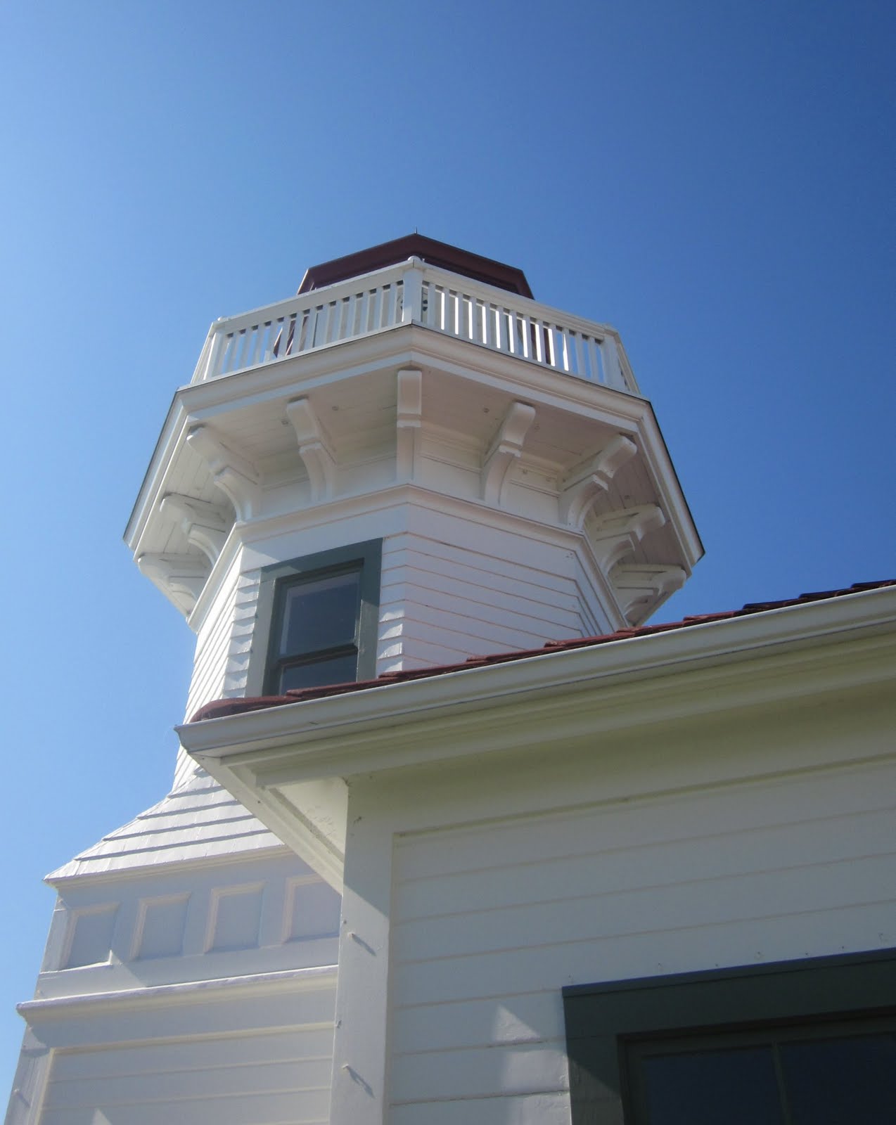 Sadly, the light is only open to look inside on the weekends. It was still pretty to look at and Lon ran around a bit more
 He rang the triangle and had a good time doing it too! I told him we would come back later to look around inside since he does not remember when I took him there before.
 We went home and had some great steaks on the grill. We even ate outside! It was another great day for adventures!
For those who want to know more about the hist
The Deception Pass area has been home to various Coast Salish tribes for thousands of years. The first Europeans to see Deception Pass were members of the 1790 expedition of Manuel Quimper on the Princesa Real. The Spanish gave it the name Boca de Flon.[1] A group of sailors led by Joseph Whidbey, part of the Vancouver Expedition, found and mapped Deception Pass on June 7, 1792.[2] George Vancouver gave it the name "Deception" because it had misled him into thinking Whidbey Island was a peninsula.[3] The "deception" was heightened due to Whidbey's failure to find the strait at first. In May 1792, Vancouver was anchored near the southern end of Whidbey Island. He sent Joseph Whidbey to explore the waters east of Whidbey Island, now known as Saratoga Passage, using small boats. Whidbey reached the northern end of Saratoga Passage and explored eastward into Skagit Bay, which is shallow and difficult to navigate. He returned south to rejoin Vancouver without having found Deception Pass. It appeared that Skagit Bay was a dead-end and that Whidbey Island and Fidalgo Island were a long peninsula attached to the mainland. In June the expedition sailed north along the west coast of Whidbey Island. Vancouver sent Joseph Whidbey to explore inlets leading to the east. The first inlet turned out to be a "very narrow and intricate channel, which...abounded with rocks above and beneath the surface of the water".[4] This channel led to Skagit Bay, thus separating Whidbey Island from the mainland. Vancouver apparently felt he and Joseph Whidbey had been deceived by the tricky strait. Vancouver wrote of Whidbey's efforts: "This determined [the shore they had been exploring] to be an island, which, in consequence of Mr. Whidbey’s circumnavigation, I distinguished by the name of Whidbey’s Island: and this northern pass, leading into [Skagit Bay], Deception Passage".[4]In the waters of Deception Pass, just east of the present-day Deception Pass Bridge, is a small island known as Ben Ure Island. The island became infamous for its activity of smuggling illegal Chinese immigrants for local labor. Ure and his partner Lawrence "Pirate" Kelly were quite profitable at their smuggling business and played hide-and-seek with the United States Customs Department for years. Ure's own operation at Deception Pass in the late 1880s consisted of Ure and his Native-American wife. Local tradition has it that his wife would camp on the nearby Strawberry Island (which was visible from the open sea) and signal him with a fire on the island's summit to alert him to whether or not it was safe to bring his illegal cargo ashore. For transport, Ure would tie the illegal immigrants up in burlap bags so that if customs agents were to approach then he could easily toss the bags overboard. The tidal currents would carry the discarded immigrants' bodies to San Juan Island to the north and west of the pass and many ended up in what became known as Dead Man's Bay.

Upon completion on July 31, 1935, the 976-foot (297 m) span Deception Pass Bridge connected Whidbey Island to the tiny Pass Island, and Pass Island to Fidalgo Island. Prior to the bridge, travellers and businessmen would use an inter-island ferry to commute between Fidalgo and Whidbey islands.

No comments:
Post a Comment