Lon slept in, I let him sleep. We did not get on the road till 8:42am.
Trains! We love Trains! I forgot to say that yesterday we saw a train with THREE Boeing fuisilages on their way west.
We stopped for gas at Big Timber, MT. As we were turning off the highway, we saw a sign for a museum. We had to check it out. We were on the Lewis and Clark Trail :)
The museum did not open till 10, so we checked out the out buildings. It was about 9:40am. A docent noticed Lon outside and opened the Crazy Mountian Museum for us early !
According to Wikipedia:
The name Crazy Mountains is said to be a shortened form of the name "Crazy Woman Mountains" given them, in compliment to their original Crow name, after a woman who went insane and lived in them after her family was killed in the westward settlement movement.
Lon still has not lost his love of dioramas. He loved this view of the town of Big Timber in 1910. He was pointing out all sorts of amazing details. The two men who made it put so much details in it that the docent was telling us she is still finding things she had not noticed after 20 years of looking at it!
Did you know that the Big Timber area exported more wool than any other place at one time? And yet on our drive we only saw one tiny place with a few sheep.
Lon is not happy that we really do have to get a move on. He could have spent a few more hours here. We were not even in Wyoming yet !
We got our gas, at 10:47 am. Our mileage was 742.5. We put in 10.11 gallons at $3.58 per gallon
Rest stop at 12:21 pm. We looked for license plates along the way. Minnesota was a favorite to find. Lon at first just kept saying Sota! But to me it sounded like soda ! Now, we call it Tiny Pop when we see a Minnesota plate. I am not sure they would like that in Minnesota. I am sure they have heard it before.
Sadly we could not go to the Little Big Horn National Monument. There was/is a fire behind Buffalo Wyoming and the smoke and ash closed the road. This is as close as we got. No one was a happy camper.
To try to get some history in, when we saw a sign for a State History Site, we went down to see what it was all about. The first thing we saw was the antelope! Can you spot them?
This is the first site.
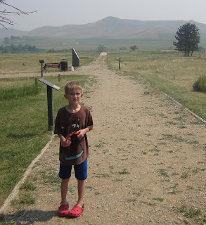
The information on what we are seeing
Wait There's more !
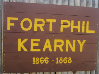
Just down the road, was this Fort and small information center. We love places like this.
A diorama of what the fort would have looked like had it still been standing.
again a bit from Wikipedia:
Fort Phil Kearny was an outpost of the United States Army that existed in the late 1860s in present-day northeastern Wyoming along theBozeman Trail. Construction began Friday July 13, 1866 by Companies A, C, E and H of the 2nd Battalion, 18th Infantry, under the direction of the regimental commander and Mountain District commander Col. Henry B. Carrington. The post was named for Maj. Gen. Philip Kearny, a popular figure in the American Civil War. The fort should be distinguished from the similarly named Fort Kearney in Nebraska, which was named for Kearny's uncle Stephen W. Kearny. Today, the fort and the nearby Fetterman and Wagon Box battle sites are maintained by the State of Wyoming as theFort Phil Kearny State Historic Site.
The fort was located along the east side of the Bighorn Mountains in present-day northern Johnson County, approximately 15 miles (24 km) north of Buffalo. Along with Fort Reno and Fort C. F. Smith, the fort was established along the Bozeman Trail in the Powder River Country at the height of the Indian Wars to protect prospective miners traveling the trail north from the Oregon Trail to present-day Montana.
Fort Phil Kearny was the largest of the three stockaded fortifications along the trail. Its eight foot (2 m) high log walls enclosed an area of 17 acres (69,000 m²). The walls measured 1,496 feet (456 m) in length, tapering in width from 600 feet (180 m) on the north to 240 feet (73 m) on the south. Construction of the stockade required more than 4,000 logs. In 1867, the building construction required over 606,000 board feet of lumber and 130,000 adobe bricks.
The fort was under continuous construction and was nearing completion in December 1866, when its garrison was due to be re-designated the 27th Infantry. At its peak strength the garrison numbered 400 troops and 150 civilians: 9 officers, a surgeon, and 329 enlisted men of five infantry companies of the 18th/27th Infantry, including the newly recruited Company K, 27th; one officer and 60 men of Company C, 2nd Cavalry, and 150 civilian quartermaster and contractor employees.
The fort, known to the Indians as the "hated post on the Little Piney", played an important role in Red Cloud's War. The area around the fort was the site of the Fetterman massacre and the Wagon Box Fight. By 1868, the Union Pacific Railroad had reached far enough west that emigrants could reach the Montana gold fields through present-day Idaho, rendering the dangerous Bozeman Trail obsolete. All three forts along the trail were abandoned as part of the Treaty of Fort Laramie (1868). Shortly after, it was burned by Cheyenne Indians.
Fort Phil Kearny, including the nearby sites of the Fetterman massacre and the Wagon Box Fight, was designated a National Historic Landmark in 1960.
Lon is really interested in this. He is turning into a tiny history buff.
He is still a little boy too!
The fort site. Then we got back on I-90 and moved on down the road.
At 3:17 we got gas in Buffalo, Wy. Mileage 1002.3. I put in 10.26 gallons at $3.74
The next rest stop.
4:06 pm
It was getting late. There was nowhere to stop, so we kept going. And going. Wyoming never seemed to end. by 6:30 we were on Highway 26 out of Casper, trying to make it to Scott's Bluff for the night. The garmin kept losing me, so I just turned it off. We stopped at the very first place we saw with a hotel. Guernsey, Wyoming. I was not sure how much farther down the road a better place was, so we stayed.
Our room at the Sagebrush Motel. I paid in cash as I was not too sure I wanted them to have my credit card number.
T
here is an upside to Guernsey, and I recommend the these sites. I had heard about a place on the Oregon Trail where travelers carved their names into the soft rock. It was so interesting to see that
Wikipedia, again:
here is an upside to Guernsey, and I recommend the these sites. I had heard about a place on the Oregon Trail where travelers carved their names into the soft rock. It was so interesting to see that
Wikipedia, again:
Lon is finding names, old and new
This one caught our eye. I am not sure I could be that brave to go out on a wagon train into the great unknown.
I think it must have looked like that back then too
Small birds are making their nests in the overhangs. At dusk they were swooping all around us. It was pretty cool.
Pony Express Station marker
More on the Pony Express:
The Pony Express was a fast mail service crossing the Great Plains, the Rocky Mountains, and the High Sierra from St. Joseph, Missouri, toSacramento, California, from April 3, 1860 to October 1861. It became the west's most direct means of east-west communication before the telegraph and was vital for tying California closely with the Union just before the American Civil War.
The Pony Express was a mail delivery system of the Leavenworth & Pike's Peak Express Company of 1849 which in 1850 became the Central Overland California and Pikes Peak Express Company. This firm was founded by William H. Russell, Alexander Majors, and William B. Waddell all of whom were notable in the freighting business.
Patee House served as the Pony Express headquarters from 1860 to 1861. It is one block away from the home of infamous outlaw Jesse James, where he was shot and killed by Robert Ford.
This original fast mail 'Pony Express' service had messages carried by horseback riders in staged relays to stations (with fresh horses and riders) across the prairies, plains, deserts, and mountains of the Western United States. During its 18 months of operation, it reduced the time for messages to travel between the Atlantic and Pacific coasts to about ten days, with telegraphic communication covering about half the distance across the continent and mounted couriers the rest
About a mile down the unpaved road is the Oregon Trail Ruts. I had heard about them, and we were here, so let's go take a look! Lon ran ahead. This was not a ADA friendly trail. It was steep and there were steps. It went up a long way
The ruts. This is amazing. There were so many wagons, so many pack animals, they wore deep ruts into the rock.
It was declared a National Historic Landmark in 1966
Even more information
Pretty flowers on the side of the road. There is a grave marker just up the road, for Lucindy Rollins. She died in 1849. Of what, no one knows anymore. The grave was lost until someone found it while duck hunting. The original grave marker is now either at the museum, or lost. But a oblisk has been put up at the spot. That was done in 1938.
Lon making his own dinner. At his request. Well, sort of. We needed to get back to get some food. It was about 7:20pm. There were three options to eat in Guernsey. One was closed, two was a bar and three was a Mexican place. Mexican it is! Well, no. We walked in. There were two tables with customers at them, but no food or drinks yet. No waitstaff at all we could see. We could hear people's voices from the kitchen, but no one came out. We waited, we waited some more. When two people who I assumed worked there walked by us and headed into the kitchen, Lon and I decided to leave. They did not say boo! to us. Lon wanted to go to the kitchen to tell them they were being rude. While I would have liked that, we needed to go. We decided to go to the grocery store. Good thing we left when we did. It closed at 8pm and we got there about 7:50. We found some peanut butter and super expensive english muffins, but they were cheaper than the regular bread! Lon also got a small blue bunny ice cream. I am glad I left the silverware holder thingy in the car! It worked out well. Lon wanted to heat up his muffins in the microwave. The plug for the microwave had been changed, they cut off the ground! It wiggled in the socket. I did not think it was all that safe. Whiley Lon was working on his dinner, I tried to blog. Well, they said they had wifi. They did. I got a signal, I typed in the numbers to connect to it. My anti virus software kept blocking me getting on. I ran a diagnostic. It told me my computer was fine and protected but the router I was trying to log into was not. Did I want to proceed? I shut down the computer. I did not have cell service either. No one really had a clue on where we were. It would have to stay like that till we got on our way. Lon and I got under the blanket we brought with us and went to sleep after our tiny dinner
Ending mileage for the day: 1237.3 miles.


No comments:
Post a Comment